Free printable activity sheet
Turn your photos into sheets like this!
Upload any photo and apply our Coloring Book style to generate a custom printable sheet of your own.
Create My OwnAletsch Glacier Activity Sheet
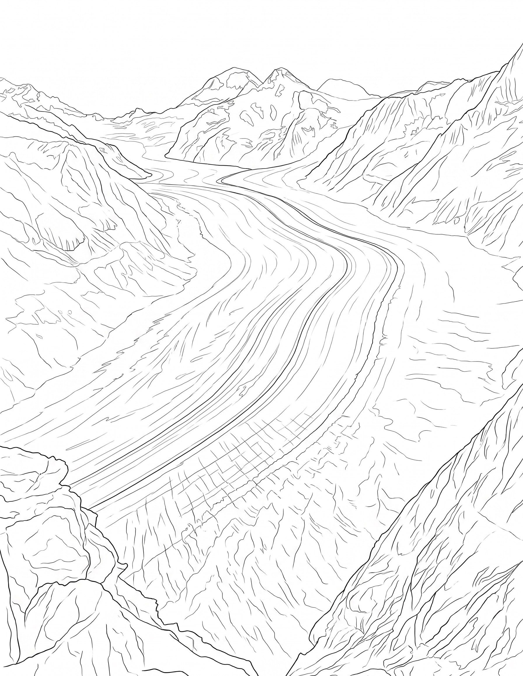
Explore Switzerland's Aletsch Glacier, the largest glacier in the Alps, with icy patterns, mountain clues, and glacier facts.
About
The Aletsch Glacier, also called the Great Aletsch Glacier, is the largest glacier in the Alps. It is located in the Swiss canton of Valais and stretches for about 23 kilometers, or about 14 miles. High in the Bernese Alps, smaller ice streams meet at a place called Konkordiaplatz before the glacier flows down toward the valley.
Glaciers form when layers of snow build up, compact into ice, and slowly move under their own weight. The Aletsch Glacier shows long lines of darker rock and debris called moraines, which help reveal how different streams of ice have joined together.
The glacier is part of the Jungfrau-Aletsch protected area, a UNESCO World Heritage Site. Like many glaciers around the world, it is retreating, which means its ice is shrinking and pulling back over time. Studying glaciers helps people understand mountains, water, climate, and the changing Earth.
History & Culture
The Aletsch Glacier has shaped the landscape of the Swiss Alps for thousands of years. During colder periods in the past, the glacier was much larger and covered areas that are ice-free today.
People now visit viewpoints near places such as Bettmerhorn and Eggishorn to see the glacier from above. Scientists, park staff, and conservation groups study and protect the area because glaciers are important natural records of climate and mountain history.
Fun Facts
The Aletsch Glacier is the largest glacier in the Alps.
It is located in Valais, Switzerland.
Dark stripes on the glacier are moraines made from rock and debris carried by the ice.
The Jungfrau-Aletsch area became a UNESCO World Heritage Site in 2001.
A Thought to Carry With You
"Big changes become easier to understand when we follow the clues one layer at a time."
Activities & Discussion
- 1
Glacier Flow Lines
Draw long curved lines down the glacier to show how ice slowly flows through the mountains. Add darker moraine stripes where rock debris collects.
- 2
Mountain Map Labels
Label the glacier, snowy peaks, valley, meltwater stream, and a viewpoint. Add arrows to show the direction the ice moves.
- 3
Climate Clue Card
Create a small fact card explaining one sign that a glacier is changing, such as retreating ice, exposed rock, or a growing meltwater stream.